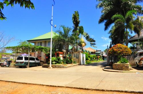
Cateel, considered as one of the oldest towns in Region XI, was once a part of the Encomienda System during the Spanish regime. The Province of Caraga was composed of four Encomiendas, namely: Encomienda de Butuan, Encomienda de Surigao, Encomienda de Tandag and Encomienda de Bislig. Cateel formed part of Encomienda de Bislig.
Brief History
Cateel, considered as one of the oldest towns in Region XI, was once a part of the Encomienda System during the Spanish regime. The Province of Caraga was composed of four Encomiendas, namely: Encomienda de Butuan, Encomienda de Surigao, Encomienda de Tandag and Encomienda de Bislig. Cateel formed part of Encomienda de Bislig.
In 1840, Governor Luis Lardezabal sent an expedition to the eastern Mindanao to organize municipalities/settlements with considerable number of inhabitants. Cateel was one of those organized. Several events happened in the succeeding years. In 1856, the townsite was moved from Lapad to the seacost, its present site-Poblacion.
After the Spanish regime in 1901, the American Military Government was established with Remegio Magno as the first Municipal President. The American Civil Government followed under the Military Government with the appointment of Mariano Dacuycuy as Municipal President.
With its pace of development, Cateel was created into a Municipality on October 29, 1903, under Organic Act No. 21, establishing Cateel as one of the municipalities of the entire region with authority of the Philippine Commission acted by the Legislative Council of the Moro Province. Its territorial jurisdiction shall include all territory bounded on the east by the Pacific Ocean, on the north by the eight parallel of north latitude, on the west by the watershed of the mountains parallel to the coast and on the south by the parallel of latitude about seven degrees thirty- five minutes north which runs through the middle of the swamp lying between the Rio Matuban and the pueblo of Quinablangan and all the islands within the three marine league limit.
After the Second World War, the inauguration of the Philippine Republic on July 4, 1946 marked the Philippine history. Francisco Castro became the first elected Municipal Mayor and Gregorio Dacuycuy as member of the Provincial Board.
The town’s Chief Executives called Municipal Presidents during the early part of the American Regime and Municipal Mayors during the Commonwealth period to present are as follows: Remegio Magno, 1900-1902; Claudio Gonzales, 1903-1905; Domingo Ibañez, 1905-1906; Mariano Dacucycuy , 1907-1912; Lorenzo Balmori, 1913; Luciano P. Villasin, 1914-1915; Jacinto Enriquez, 1916-1924; Gregorio Dacucycuy, 1925-1931; Franciso Enriquez, 1932-1940; Gregorio Dacucyuy, 1941-1944; Julian Gonzales (appointed by the guerillas), 1944-1945; Pedro Losentes (appointed by Pres. Roxas) , 1946-1947; Francisco Castro, 1948-1951; Santiago Silverio, 1952-1963; Pedro Castro, 1964 (he died in office on May 6, 1964); Misael Clamor, 1964-1967; Elano Cabrera, 1968-1971; Proculo B. Abarca, 1972-1983 ( he died in office on May 13, 1983; Giselo V. Castillones, 1983-1986; Agardo D. Reyes, 1986 (appointed OIC Mayor by President Corazon C. Aquino); Nemesio M. Magno, 1986-1987 (appointed OIC Mayor by Pres. Corazon C. Aquino); Dr. Isidro S. Castro, 1988-1995 and Camilo T. Nuñez , 1995 up to the present.
Presently, the Municipality of Cateel is composed of sixteen (16) barangays with their corresponding legal basis for creation as follow: Barangays Basis of Creation Date Created 1. Abejod Resolution No. 30 May 15, 1968 2. Alegria RA 3590 June 22, 1963 3. Aliwagwag Res. No. 169-A August 28, 1968 4. Aragon RA 3590 June 22, 1963 5. Baybay Res. No. 79 May 15, 1968 6. Maglahus RA 3590 June 22, 1963 Mainit RA 3590 June 22, 1963 Malibago Res. No. 322 August 16, 1969 Poblacion RA 3590 June 22, 1963 San Alfonso RA 3590 June 22, 1963 San Antonio RA 3590 June 22, 1963 San Miguel Res. No. 347 May 15, 1969 San Rafael RA 3590 June 22, 1963 San Vicente Res. No. 90 May 22, 1968 Sta. Filomena RA 3590 June 22, 1963 Taytayan RA 3590 June 22, 1963.
How Cateel Got Its Name?
In 1610, Sgt. Juan Camachode dela Peña and Fr. Miguel de Sto. Tomas visited Cateel. They landed at the northern side of the river bank before called Sitio Lapad, now Barangay San Rafael. After giving their offering for a safe landing, the two encomienderos entered within the vicinity following the path. They came to land where a man was busy splitting a piece of rattan vine. The strangers asked the man what the place was called, the man replied “CATEEL”, thinking that they were asking him the name the vine he was splitting. From then on, the valley and the river were then called “Cateel”.
Demography Population
(2000) : 28,317 Average Growth Rate (1990-1995) : .0080% Population Density (2000) : 0.60 No. of Households (2000) : 5,529 Major Dialect : Davaweño (89.87%) Dominant Religion : Roman Catholic (92.90%) Major Ethnic Groups : Mandaya, Cebuano, Ilocano, Butuanon, Bisaya Literacy Rate (1995) : 89.9% Labor Force (1995) : 8,796 Unemployment Rate (1995) : 8.08% C. Natural Features Location/Boundaries:
Cateel is bounded by the Pacific Ocean in the east, Municipality of Compostela , Province of Davao del Norte in the west, the Municipalities of Boston and Baganga in the north and south respectively.
Accessibility
Cateel is accessible by land and water transportation. It is 160.11 kilometers away from the Municipality of Mati, the capital town of Davao Oriental. And, it is 360 kilometers away from the regional center, which is the City of Davao.
Source:
