Geography
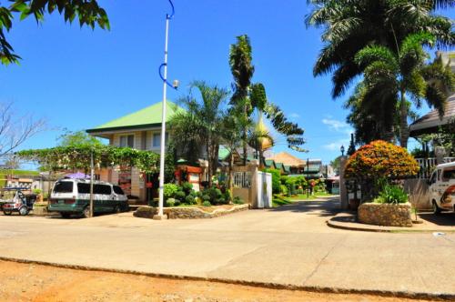
Tawi-Tawi lies at the southwestern tip of the country. Irregular in shape, with splashes of white sandy beaches and rock-bound coasts, the province has 107 islands and islets with a combined land area of 462 square miles.
Political Subdivisions
The province is composed of ten municipalities: Balimbing, Bongao, Cagayan de Tawi- Tawi, Simunul, Sitangkai, South Ubian, Tandubas, Turtle Island, Languyan and Sapa-Sapa. There are from ten to more than thirty barangays in each municipality. Each barangay is administered by a Barangay Captain.
Climate
Tawi-Tawi has two seasons: dry and wet The climate is generally moderate. The wettest months are from August to November. The other months of the year are generally dry with occasional rain showers.
Language / Dialect
The prevailing dialect is Samal, which is widely used in varied tones and accents. The Tausug dialect is also spoken, as are English and Filipino (Tagalog). Many local traders can speak Malay and Indonesian.
Major Industries
Agriculture, fishing, and agar-agar farming are the leading source of livelihood of the people of Tawi- Tawi, with quite a number engaged in the barter trade business. Copra is the top agricultural produce, followed by root crops, fruits, and vegetables.
Travel Information
Sure the security situation in Tawi-Tawi is a major concern, but given enough support the country’s southernmost province has a huge tourism potential. Located in the Autonomous Region in Muslim Mindanao, this island province is abundant in marine resources, particularly seaweeds. Tawi-Tawi, which is also known as the Philippines backdoor gateway to Southeast Asia, is also home to white beaches that are perfect for weekend getaways.
Source: